Geological Remote Sensing Group
ارائه خدمات تخصصی سنجش از دور و اکتشافات معدنی
Geological Remote Sensing Group
ارائه خدمات تخصصی سنجش از دور و اکتشافات معدنیدرباره من
روزانهها
همه- دانلود داده های استر
- مشاهده و دریافت داده های لندست و سنتینل
- پایگاه جامع در مورد تصاویر ماهواره ای مختلف
- گل نرگس
- NASA Space Flight
- سازمان فضایی اروپا
- سازمان فضایی کانادا
- سایت منابع طبیعی کانادا
- سرویس علمی ایسنا
- داده و نرم افزارهای سنجش از دور
- SAGA
- مرجع اطلاع رسانی معادن فلزی ایران
- دانلود رایگان تصاویر ماهواره ای (گلویس)
- دانلود تصاویر ماهواره ای 2(ارث اکسپلورر)
- انتشارات سازمان زمین شناسی امریکا
- سایت تخصصی GIS
- دانلود تصاویر لندست-سازمان زمین شناسی امریکا
- آموزش دانلود تصاویر ماهواره ای به کمک گوگل ارث
- موسسه سنجش از دور بصیر
- دانلود رایگان تصاویر ASTER GDEM
- دانلود رایگان تصاویر ASTER GDEM با استفاده از فایل shp.*
- سایت فصلنامه علمی-پژوهشی علوم زمین
- قیمت روز کانی های صنعتی
- کتابهای آنلاین سازمان زمین شناسی کشور
- انواع مختلف تصاویر ماهواره ای Satellite Imaging Corporation (SIC
- تصاویر ماهواره ای با رزولوشن بالا DigitalGlobe
- Earth Science Australia
- International Union of Geological Sciences
- اخبار پیام نور
- سازمان ناسا
- سازمان زمین شناسی آمریکا
- بازار فلزات ایران
- پایگاه اطلاع رسانی دانشگاه نیوز
- دانشگاه پیام نور تهران - مرکز شرق
- مرکز تحقیقات فرآورى مواد معدنى ایران
- مدیریت زمین شناسی و اکتشافات معدنی شمال شرق کشور
- وزارت صنایع و معادن کشور
- سازمان نقشه برداری کشور
- قرآن مجید
- پایگاه خبری علوم زمین کشور
- گروه پژوهشی اکتشاف ذخایر معدن شرق کشور
- سازمان نظام مهندسی معدن کشور
- سازمان سنجش
- پیام نور شاهین شهر
- دانشنامه رشد
- سازمان زمین شناسی و اکتشافات معدنی
- پایگاه ملی داده های علوم زمین
پیوندها
- کتابراه
- Olympus
- ویکی مپیا
- EXELISIVIS
- کتابخانه ملی
- پژوهشکده رازی
- دنیای علوم زمین
- دانشگاه بریستول
- قیمت مواد معدنی
- دستگاه XRF پرتابل
- کانسارهای اورانیوم
- اخبار زمین شناسی
- کانسار مس در ایران
- مرجع دانلود نرم افزار
- Earth Science Data
- گوهر شناسی آنلاین
- National Geographic
- سایت سنگ شناسی
- زمین شناسی نظامی
- سامانه کاداستر معدن
- شبکه آزمایشگاهی نانو
- johnbetts-fineminerals
- Mineralogy Database 3
- Evans Analytical Group
- Mineralogy Database 2
- Mineralogy Database 1
- بانک داده های علوم زمین
- کانی شناسی و جواهرات
- جدول تناوبی آنلاین عناصر
- پایگاه اطلاع رسانی گوگرد
- کانی شناسی - ویکی پدیا
- انجمن Economic Geology
- نشریه Economic Geology
- پروژه های USGS در افغانستان
- بانک اطلاعات علوم زمین کشور
- سفارش داده های WorldView-3
- دستگاه تهیه مقطع تمام اتوماتیک گروه صنعتی طیف آذرین
- دانستنیهای زمین شناسی آمریکا
- Gemological Institute of America
- آرشیو داده ماموریتهای فضایی ناسا
- انجمن زمین شناسی اقتصادی ایران
- مرجع دانلود کتاب های زمین شناسی
- نمونه هایی از داده های WorldView-3
- دانشگاه هاروارد_مرکز تحلیل جغرافیایی
- ویکیپدیا، دانشنامهٔ آزاد-رده زمین شناسی
- شرکت Harris، جدیدترین بروزرسانیهای ENVI حامی ENVI
- جستجو و سفارش آنلاین داده های DigitalGlobe
- دانلود منابع و کتب علمی-متخصصان جوان صنعت نفت
- مدیریت زمین شناسی و اکتشافات معدنی جنوب شرق
- News and Information About Geology and Earth Science
- مدیریت زمین شناسی و اکتشافات معدنی منطقه شمال شرق کشور
- سیستم فراگیر مدیریت اطلاعات مکانی (GDMS)-سازمان زمین شناسی ایران
دستهها
ابر برجسب
دور سنجی زمین شناختی سنجش از دور نرم افزار ENVI Portable Basemap Server تصاویر ماهواره ای ARC GISبرگهها
جدیدترین یادداشتها
همه- آموزش فراخوانی تصاویر سرور نقشه گوگل و سایر سرورهای آنلاین تصاویر ماهواره ای داخل ARC GIS
- دانلود نرم افزار ENVI 5.3
- آموزش آنلاین نرم افزار
- نسخه چاپی کتاب آموزش گام به گام ENVI 5.3
- دانلود نسخه های 10.4 و 10.5 نرم افزار ArcGIS
- کتاب الکترونیکی آموزش گام به گام ENVI 5.3
- ارائه داده ها و اطلاعات در حوزه زمین شناسی اقتصادی
- نقشه شیتهای 250 هزار
- سینهای داده ماهواره ای لندست 8 پوشش دهنده ایران
- دستورالعملها، قوانین و استاندارد های لازم به اجرا در امور زمین شناسی و اکتشافات معدنی کشور
- نقشه زمین شناسی 250 هزار شیتهای پوشش دهنده استانهای اصفهان، آذربایجان غربی و شرقی برای استفاده در نرم افزار اوراکس مپ موبایل
- نقشه زمین شناسی مخصوص نرم افزار اوراکس مپ موبایل
- روش انتقال نقشه زمین شناسی به موبایل
- آموزش تهیه نقشه های توپوگرافی
- دانلود کتاب زمین شناسی فیزیکی-انتشارات پیام نور
- QGIS 2.12
- کانال زمین شناسی اقتصادی در تلگرام
- دانلود نسخه حرفه ای گوگل ارث Google Earth Pro 7.1.4.1529
- چینه شناسی آنلاین
- دانلود نرم افزار ENVI 5.3
- CAE Datamine Studio 3.21.7164.0
- جدیدترین نسخه نرم افزار ESRI ArcGIS
- Autodesk AutoCAD Map3D 2016
- نسخه جدید نرم افزار Global Mapper
- پایگاه اطلاعات نشریات کشور
- دانلود نقشه های توپوگرافی
- اصطلاحات جغرافیا
- کتاب شیمی تجزیه دستگاهی
- EarthscienceWorld
- GeoScienceWorld
- eJournals in Geology
- GDMS
- Evans Analytical Group
- Handheld XRF Analyzer
- جدول تناوبی آنلاین
- خلاصه ای از مهمترین روش های تجزیه مواد معدنی
- کتاب های زمین شناسی
- ASTER GDEM
- the mineral and locality database
- مواد معدنی
- بانک اطلاعات معادن و کانسارها
- مجله علمی-پژوهشی زمین شناسی اقتصادی
- دانلود نشریات داخلی علوم زمین
- زلزله
- اموزش رایگان Surfer
- فیلم آموزش دانلود رایگان تصاویر ماهواره ای Aster , Landsat &...
- کتاب مبانی تهیه نقشه های زمین شناسی
- مشخصات اصلی کانه ها
- John DuNann Winter
- اطلس آنلاین
بایگانی
- مهر 1398 1
- بهمن 1395 2
- آبان 1395 1
- مرداد 1395 2
- تیر 1395 1
- فروردین 1395 2
- اسفند 1394 5
- بهمن 1394 1
- دی 1394 1
- آذر 1394 2
- آبان 1394 1
- مهر 1394 1
- خرداد 1392 1
- اردیبهشت 1392 1
- آذر 1391 2
- آبان 1391 1
- اردیبهشت 1391 2
- بهمن 1390 5
- دی 1390 1
- آذر 1390 1
- آبان 1390 3
- شهریور 1390 1
- مرداد 1390 1
- خرداد 1390 2
- اردیبهشت 1390 3
- فروردین 1390 2
- اسفند 1389 1
- دی 1389 1
- آذر 1389 4
- آبان 1389 1
- مرداد 1389 1
- تیر 1389 1
- خرداد 1389 1
- فروردین 1389 3
- اسفند 1388 6
- بهمن 1388 6
- دی 1388 15
جستجو
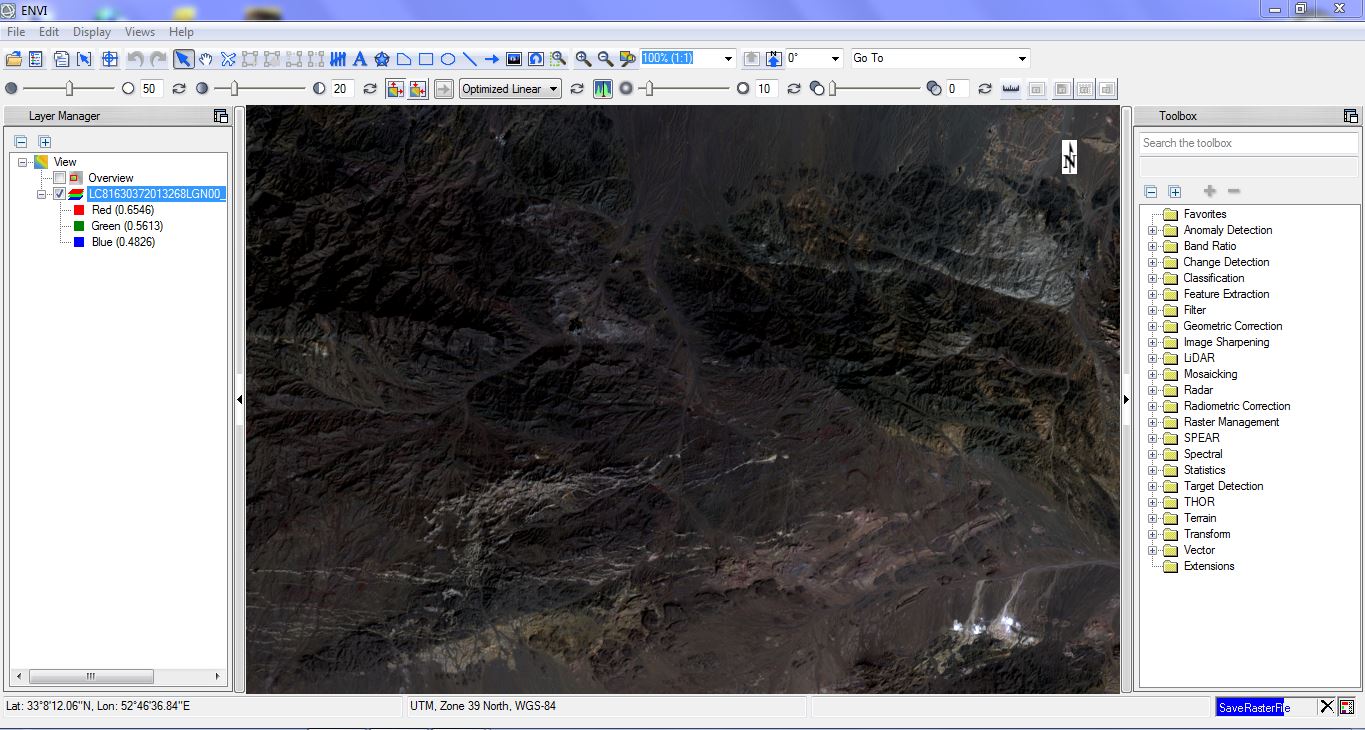
دانلود نرم افزار ENVI 5.3

نرم افزار ENVI 5.3 نسخه 64 بیتی به همراه لایسنس معتبر
دانلود نرم افزار ENVI 5.3 نسخه 64 بیتی روی لینکهای زیر کلیک کنید:
دانلود لایسنس نرم افزار (حجم 13 مگابایت)
این فایل بعد از دانلود با هر نرم افزار مدیریت آرشیو فایل اکسترکت می شود.
مراحل نصب را مطابق فایل راهنما انجام دهید.
لینک منبع فایل:
Exelis ENVI v5.3, IDL v8.5, LiDAR v5.3
(توجه کنید که برای فعال شدن لینک دانلود باید اول داخل سایت مربوطه ثبت نام کنید)
روش اجرای لایسنس نرم افزار (کاملا تست شده و معتبر است) :
فولدر لایسنس حاوی 2 فایل است که باید در مسیر نصب برنامه و در محل مخصوص به خود کپی شود
:
“IDL” folder copy to : C:\Program Files\Exelis
license file copy to : C:\Program Files\Exelis\License
تذکر مهم : بعضی از آنتی ویروسها فایلهای لایسنس را بعنوان فایل مخرب شناسایی میکنند که بعد از کپی کردن فایلهای لایسنس در مسیرهای مربوطه اگردر هنگام اجرای برنامه با پیغام خطای لایسنس مواجه شدید، به بخش قرنطینه آنتی ویروس مراجعه کرده و فایلها را به لیست سفید یا مشابه آن منتقل نمایید.
لطفا در صورت بروز هرگونه ایراد و اشکال در مراحل دانلود و نصب از طریق همین وبلاگ یا راههای ارتباطی ذیل مطرح فرمایید:
09103461018
ECGEOLOGY@YAHOO.COM
لینک سفارش اینترنتی نسخه چاپی کتاب آموزش گام به گام ENVI5.3 از فروشگاه آنلاین انتشارات آرنا
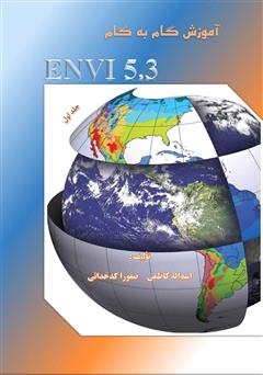
دانلود کتاب آموزش گام به گام نرم افزار ENVI 5.3

- تالیف: اسداله کاظمی، صفورا کدخدایی
- تعداد صفحات: ۴۲۰
- زبان: فارسی
- فرمت: EPUB
- سایز: ۱۸.۳۲ مگابایت
- تاریخ انتشار: ۱۳۹۵
What’s New in ENVI 5.3
Author: Abby Lehman / Friday, September 18, 2015
ENVI 5.3 is packed full of new features and functionality that will help you do more with your geospatial data than ever before. Watch this webinar to learn how the newest version of ENVI can help you improve your geospatial analysis!
Watch this webinar and learn about:
NEW significant LiDAR point cloud analysis and visualization capabilities now come with your ENVI software, including ENVI API enhancements to programmatically access point clouds for custom extension development, batch processing, and enterprise deployments
.NEW synthetic 3D point-cloud generation from stereo optical imagery to take advantage of existing commercial imagery archives and create point-cloud and terrain products in areas where collecting LiDAR is not feasible or more expensive than simply acquiring imagery.
NEW enhancements to the spatiotemporal analysis toolset to view and understand how any given pixel in a scene has changed over time.
NEW additions to the ENVITask system enable users to programmatically call discrete bits of image processing through the ENVI API.
NEW IDL Python bridge to seamlessly integrate Python code into ENVI or wrap ENVI analytics into ArcGIS®.(Reference:http://www.exelisvis.com/Home/NewsUpdates/TabId/170/ArtMID/735/ArticleID/14618/What%E2%80%99s-New-in-ENVI-53.aspx)
آموزش آنلاین نرم افزار

آموزش آنلاین نرم افزار های ENVI و ArcGIS بوسیله Skype و Team Viewer
توسط گروه سنجش از دور کیمیا پژوهان
ویژه دانشجویان زمین شناسی و معدن
جهت کسب اطلاعات بیشتر به آیدی تلگرام ما پیام دهید:
